
Help
Last Database Update mm/dd/yy
Geographic Names Server
Next Database Update mm/dd/yy
Current GNS Count:
Features and
Names
The GNS is current to GENC Standard Ed
Update
Geographic Names Server
Geographic Names Search
Geographic Names Search - Quick Help


Looking for U.S. or Antarctic names?
Frequently Asked Questions
How come I can't search for a domestic name like Los Angeles?
Why can't I open GeoNames documents and document-links in Safari browser?
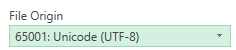
When I open .csv geographic names files in Excel, the characters aren't rendering correctly. How do I fix that?
Why do certain points/features appear to be gridded?
What does a particular data attribute or field mean?
How do I know what these various data codes mean?
The filter by visible extent option in the search application isn't giving me the "right" number of records.
Why do some features have more than one name associated with them, and which one should I use?
What happened to the old options to Embed GNS on your site, Easy Search, or use Kitchen Sink?
Found some data that needs correction?
Send us an email
geonames@nga.mil
Need more help?
Send us an email
geonames@nga.mil
Contacts -
GNS Support
Commercial: (571) 557-5959
DSN 547-5959
geonames@nga.mil
-
Advisory Committee on
Undersea Features (ACUF)
underseafeatures@nga.mil